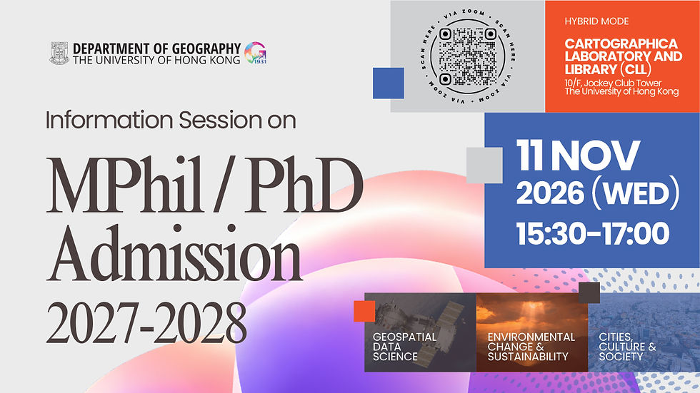
19 NOV 2026 (THU) 11:30–12:15 | 14:00–14:45 | 15:15–16:00 | 16:30–17:15
Departmental Research Seminars Series
Physical Geography
Date: 19 NOV 2026 (Tuesday)
Time: 11:30–12:15 | 14:00–14:45 | 15:15–16:00 | 16:30–17:15 (HKT)
Venue: CLL, Department of Geography, 10/F, The Jockey Club Tower, Centennial Campus, HKU
Registration link: TBC
11:30–12:15 (via Zoom)
Advancing Agroecosystem Sustainability through Geospatial Data Science
Abstract: Agricultural systems are facing increasing pressures from population growth, urbanization, and climate change, while also contributing significantly to environmental degradation, including deforestation, biodiversity loss, and groundwater depletion. Understanding the complex interactions among agricultural production, environmental processes, and human activities is essential for advancing global food security and sustainability. Recent advances in satellite remote sensing, AI, and geospatial data science provide unprecedented opportunities to observe, understand, and manage agroecosystems across scales. In this seminar, I will present my research on developing advanced geospatial approaches to characterize key agricultural and environmental variables. First, I will discuss advances in thermal, microwave, and optical remote sensing for estimating land surface temperature, soil moisture, and vegetation productivity. I will then highlight my recent work on mapping global arable land and investigating the effects of agricultural field size on crop production. Finally, I will introduce my ongoing research on global irrigation mapping at 30-m spatial resolution. Collectively, these studies demonstrate the potential of remote sensing to advance agricultural sustainability, while highlighting the importance of an interdisciplinary approach to understanding and managing coupled human-natural systems.
Dr. Lun GAO
Postdoctoral Associate, Institute on the Environment, University of Minnesota Twin Cities;
Visiting Scholar, Oak Ridge National Laboratory, United States Dr. Lun Gao is currently a Postdoctoral Associate at the Institute on the Environment, University of Minnesota Twin Cities, and a Visiting Scholar at Oak Ridge National Laboratory. He received his Ph.D. in Civil Engineering (Water Resources) from the University of Minnesota Twin Cities in 2022, followed by two years of postdoctoral research at the University of Illinois Urbana-Champaign. His research focuses on advancing the understanding of global food-water-land-climate interactions through satellite remote sensing, AI, and statistical modeling. His work involves land surface temperature, soil moisture, vegetation optical depth, plant photosynthesis, agricultural land mapping, crop field size, and irrigation. To date, he has published 12 first-author papers in leading scientific journals, including Nature Communications, Remote Sensing of Environment, Geophysical Research Letters, and IEEE Transactions on Geoscience and Remote Sensing.
14:00–14:45 (in person)
Water Vulnerability under Environmental Change: From the Tibetan Plateau to the Globe
Abstract: Climate change and human activities are reshaping the terrestrial water cycle, altering how much water is stored on land and how it moves through river basins. These changes pose growing challenges to sustainable water supply and hydroclimatic risk management, particularly in regions where ground-based observations remain sparse. This seminar will illustrate how satellite Earth observations, AI-enabled modelling, and hydrologic process analysis can be integrated to quantify and understand changes in terrestrial water storage and runoff, drawing on research from the Tibetan Plateau and extending to the global scale. It will also examine water vulnerability arising from compound limitations in both water storage and runoff, highlighting their complementary roles as the buffering and renewable components of water availability. Together, these studies advance understanding of hydrologic responses to environmental change across scales, offering new insights for sustainable water management and climate adaptation.
Dr. Xueying LI
Marie Curie Research Fellow, School of Geography and the Environment, University of Oxford, United Kingdom
Dr. Xueying Li is a hydrologist and an Earth observation scientist focusing on water vulnerability under environmental change. She is a Marie Curie Research Fellow at the School of Geography and the Environment, University of Oxford. Before joining Oxford, she received her PhD from Tsinghua University and conducted postdoctoral research at the Helmholtz Centre for Environmental Research (UFZ) in Germany. Her research investigates multiscale changes in water storage and hydrologic fluxes, integrating satellite remote sensing, AI-enabled modelling, and process-based hydrologic analysis. She currently leads an EU-funded project on global water stress and co-leads an ESA-supported Earth observation project on agricultural water resources. Her work has been published in leading journals including Nature Climate Change (cover paper; ESI 1% Highly Cited), Water Resources Research, and Remote Sensing of Environment, and has received more than 1,800 Google Scholar citations and coverage by around 160 news outlets worldwide.
15:15–16:00 (in person)
Forest composition matters: Biogeophysical climate impacts of forest changes in Europe
Abstract: Apart from carbon sequestration, forests can also affect climate through biogeophysical (BGP) processes that influence surface energy balance, atmospheric circulation, and the hydrological cycle. Previous studies focused on forest cover, but ignore the fact that BGP properties vary among forest with different composition. In this study, I will present findings from two studies investigating how idealized changes in forest cover and composition influence European climate, based on a set of regional climate simulations with COSMO-CLM2. The first study examines the extreme temperature responses, highlighting how differences in BGP properties can alter the climatic effectiveness of European forests. Importantly, converting coniferous to broadleaved trees can help alleviate the BGP warming induced by forestation in high-latitude regions, especially on heat extremes. In addition, a simple climate model emulator, MESMER-L-X, is developed to promptly reproduce the `local` temperature feedback to forest changes. The second study extends this investigation to precipitation, revealing that forest changes can affect local and downwind precipitation through dynamic, thermodynamic, and nonlinear processes. Importantly, broadleaved and coniferous forests induce contrasting precipitation responses across parts of inland Europe. Through atmospheric circulation analysis and Lagrangian moisture tracking, we identify two key mechanisms underlying these contrasting responses: changes in surface roughness that modify atmospheric circulation and moisture transport, particularly in winter, and changes in evapotranspiration that influence moisture recycling and downwind precipitation, especially in summer. Together, these studies demonstrate that the BGP climate impacts of European forests are strongly dependent on forest composition, geographical location, and season. Our findings highlight the importance of moving beyond forest cover alone and incorporating forest composition and its associated climate feedbacks into the design of more effective and sustainable forest management strategies.
Dr. Yi YAO
Research Consultant, International Institute for Applied Systems Analysis (IIASA)
Dr. Yi Yao has been a Research Consultant at the International Institute for Applied Systems Analysis (IIASA) since October 2026. He obtained his PhD in Climate Science from Vrije Universiteit Brussel (VUB), Belgium, in January 2024, and subsequently worked as a Postdoctoral Researcher at ETH Zurich, Switzerland, until September 2026. He has also undertaken research visits to the National Center for Atmospheric Research (NCAR) and Pacific Northwest National Laboratory (PNNL) in the United States. His research focuses on land–atmosphere interactions, hydrology and water resources, and climate-related heat and moist-heat exposure, with particular emphasis on the climatic and hydrological impacts of irrigation and forest cover changes. His work primarily involves Earth System Models, Regional Climate Models, and Land Surface Models. He is also actively involved in international model intercomparison initiatives, including CMIP7 and ISIMIP3. His research has been published in leading peer-reviewed journals, including Nature Water, Nature Communications, and Journal of Advances in Modeling Earth Systems.
16:30–17:15 (in person)
From past to future: sea-level system science to support coastal resilience in Hong Kong and beyond
Abstract: Sea-level rise is one of the clearest signs of climate change. It is already reshaping coastal environments through more frequent flooding, enhanced erosion and saltwater intrusion. Along China’s coast, home to hundreds of millions of people and to megacities such as Hong Kong and Shanghai, effective management of these risks requires sea-level information that is accurate, uncertainty-aware and relevant at local scales. Such information, in turn, depends on understanding how the ocean, ice sheets and glaciers, the solid Earth and human activities each contribute to relative sea-level change.
In this seminar, I will show how combining physically based models, artificial intelligence (AI) and observations, from geological records and tide gauges to satellites, can quantify these contributions from the past to the future and from global to local scales. First, using geological sea-level records from southeastern China, we showed that global mean sea level was stable for about 4,000 years before the mid-nineteenth century, that its rise since 1900 has been faster than in any century over at least the past four millennia, and that human-driven subsidence has amplified this rise in China's coastal cities (Lin et al., 2025, Nature). Second, by comparing tide-gauge records with a counterfactual world without greenhouse-gas emissions, we found that human-caused sea-level rise was responsible for more than 70% of extreme coastal flooding days in Hong Kong since 2010 (Gilford, Lin et al., 2026, Science Advances). Third, using AI emulation constrained by satellite observations, we showed that the Antarctic Ice Sheet is very likely committed to losing ice by the end of this century, even if warming is limited to 1.5 °C, and identified the processes that matter most for its future (Lin et al., 2026, Nature Geoscience).
I will conclude by discussing how physics-informed AI can translate these global insights into local sea-level projections and coastal exposure assessments that support adaptation in Hong Kong and beyond.
Dr. Yucheng LIN
Assistant Professor, School of Energy and Environment, City University of Hong Kong, Hong Kong
Yucheng Lin is an Assistant Professor at City University of Hong Kong. He received his PhD in Physical Geography from Durham University (UK) and was then a postdoctoral researcher at Rutgers University (USA) and a Research Scientist at CSIRO (Australia). His research combines geophysics, Bayesian statistics and artificial intelligence to reconstruct the past, characterise the present and project the future of sea-level change, to examine its interactions with human activity, and to quantify future climate risk. He has published first-author papers in journals including Nature, Nature Geoscience and Nature Communications, and led the development of sea-level projects supported by the US National Science Foundation and the Australian Climate Service. His work has been covered by over 230 media outlets and cited in policy documents, including the 2026 report of the UN Secretary-General on sea-level rise (A/81/74), which informed the first globally negotiated Sea-Level Declaration.